
4.1 SketchUp
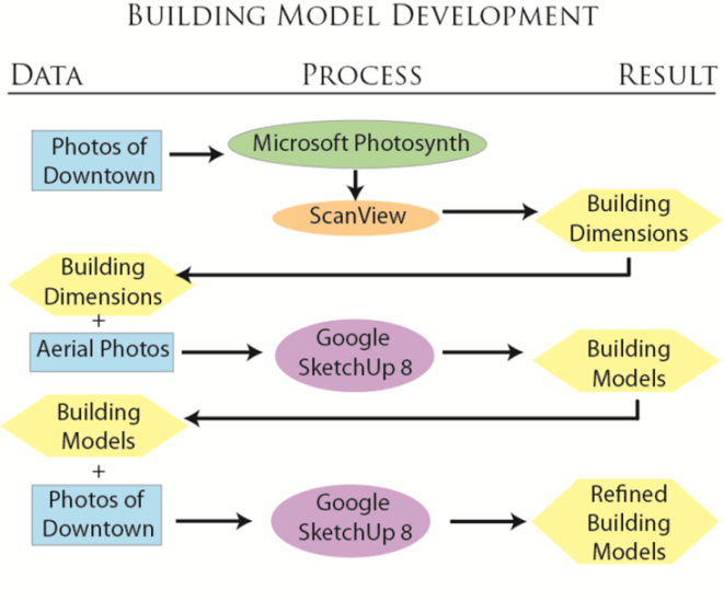 |
Figure 3. Our methodology for building model development.
Our methodology consisted primarily of using Google SketchUp to develop the 3D model of downtown Lockhart (Figure 3). This process required the greatest amount of time, and incorporated our photographic data and aerial imagery to generate this accurate representation. The process of utilizing Google SketchUp was a time-consuming one, but ultimately is the most efficient way to produce three-dimensional models of buildings. Google SketchUp is a free CAD software application that has many capabilities and a large online network of users that frequently contribute ideas, tutorials, and information. In this way, SketchUp is an extremely useful software application due to the amount of helpful information that can easily be found on the internet.
First, we used our digital photographs of each building to generate a point cloud dataset using Microsoft Photosynth. Using Synth Export we exported .PLY files of the point cloud data. A .PLY file contains a set of X, Y, and Z coordinates along with red-green-blue color information and can be edited as a text file. Deleting the header and saving the file with a different extension essentially changes the file format. To us the point cloud data to take measurements, we deleted the header and saved the file as a .XYZ file. This file was then imported into ScanView, which was used to take measurements of each building (Figure 4). While the measurement from ScanView was not to scale, we were able to use the ratio of the measurement of the height of one floor of a building to determine the measurements for other portions of the building (x/11 ft = y/z). Once the building dimensions were obtained, we used the aerial photo in Google SketchUp to draw a georeferenced building footprint which was then extruded to the proper height. We then overlaid our photographs of each building face on the model to then further generate the building details.
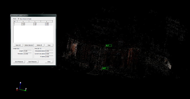 |
Figure 4. Measuring point cloud data in ScanView.
Once finished with the building models, we uploaded each building to 3D Warehouse. The 3D Warehouse is an online source for 3D building models that is linked with Google Earth. Once a model is completed in SketchUp, it must go through an approval process once loaded into the 3D Warehouse in order to be displayed on Google Earth. This approval process may take up to 30 days. Once the models are approved, they will be automatically displayed in the web application along with the building tags.
4.2 Point Cloud Processing
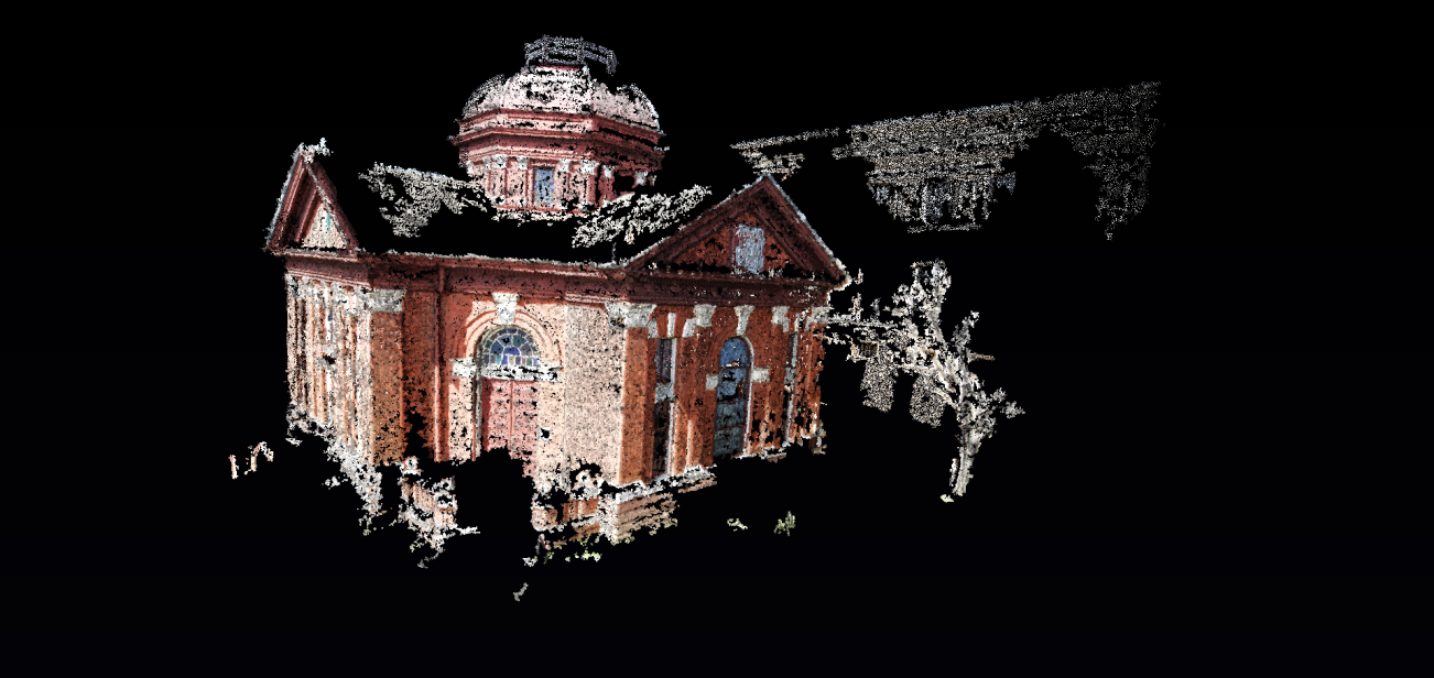
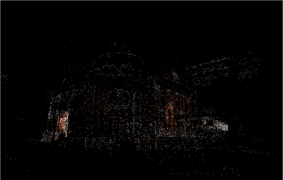
Our team also experimented with post-processing point cloud data from Microsoft Photosynth to develop our 3D model (Figure 5). Once the point cloud was developed in Microsoft Photosynth, we used Henri Astre’s Photosynth Toolkit with PMVS2 (Patch-based Multi-View Stereo Software, version 2.0) to refine the point cloud dataset. The result was an extremely dense 3D point cloud that was used to develop a wireframe mesh using MeshLab (Figure 6).
 |
 |
| Post processed point cloud generated from using PMVS2 | Point cloud generated by Microsoft Photosynth |
Figure 6. Comparison of the post processed point cloud vs. the standard Photosynth point cloud

|
|---|