Summary
In October 2013 a sudden and large amount of precipitation in the Texas Hill Country area caused a major flood event that was devastating to Freeman Center, also known as Freeman Ranch. Individuals who were at the center were trapped until the flooding subsided, and the ranch suffered $140,000 in fence damage.
GeoTrek: The Next Generation (GeoTrek: TNG) will use a GIS to create a real-time flood prediction model to aid Freeman Ranch in visualizing where flooding is likely to occur, thus helping to minimize the repercussion of flood events in the future.
Purpose
The primary goal of this project is to create a flood prediction model for Freeman Ranch to determine which fences, roads, and pastures are most vulnerable to rising waters. This study will provide a real time model of which areas of Freeman Ranch will become inundated at specific time intervals during a precipitation event. It will also identify portions of fence line and access roads that could be considered “high risk zones” or areas that are more likely to be damaged during certain flood levels.
Methodology
In order to create a real-time flood prediction model our team:
- Gather appropriate data
We will gather the necessary data and will determine the variables needed for the analysis. - Process data
Then, each variable will be projected as a layer in the GIS that and we will create a grid-system to do the analysis in step 3. - Conduct GIS analysis
Next, we will use ArcMap (a component of ArcGIS) to analyze where the flooding will occur using the concept of cellularautomation. For this particular project, the variables that will be used to obtain the values per cell are listed under the terrain and weather data. To visualize the real-time results, we will create a time variable to determine where flooding will occur at which time. We will then use the Freeman Ranch data from section to aide in visualizing which areas will be affected at which times. - Compare findings to known data
Next, we will compare our results to the known data from the flood event in October 2013, and will iterate the steps in out GIS analysis until our analysis is accurate. - Compile final deliverables
Finally, we will create a real-time flood model for users to determine how much flooding will occur after a certain amount of time.
GeoTrek: The Next Generation has created a working flood inundation model for Freeman Ranch. Freeman Ranch is located in the Sink Creek watershed and is a flash flood prone area. With our flood inundation model users will be able to visualize a rough estimation of when a flood will affect infrastructure. With GeoTrek: TNG’s model Freeman Ranch will become a safer place for both livestock and humans during potential flash flood events.
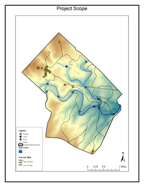
Flood Model Area of Interest: Freeman Ranch