Maps- Click the image for full extent of each map
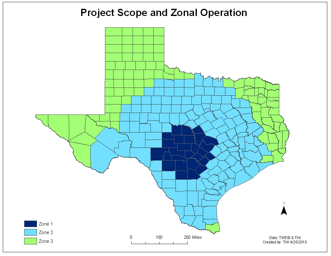 The project scope and prioritizing by zone
 Previously existing databases and the compilation of them
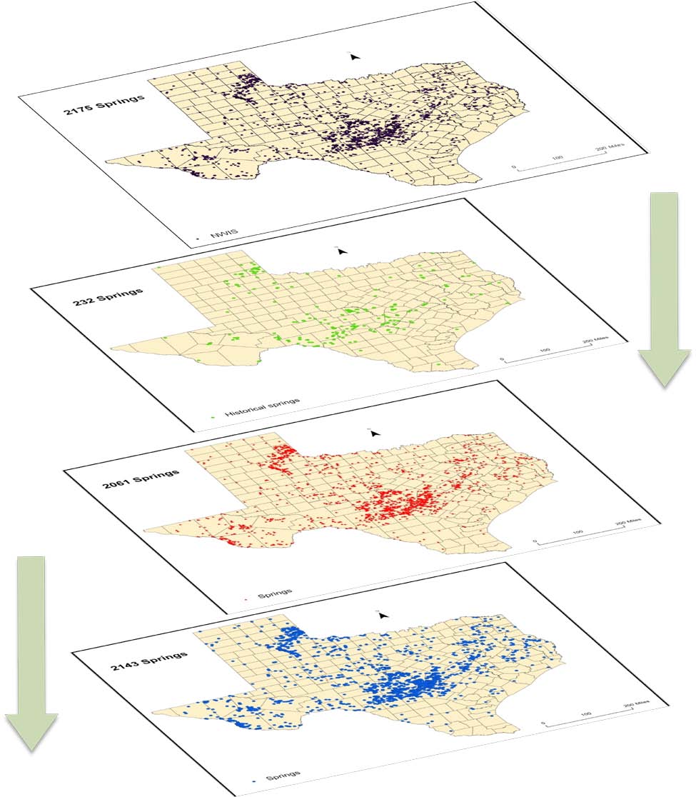
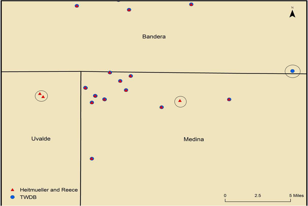 These maps show the inconsistancies between datasets
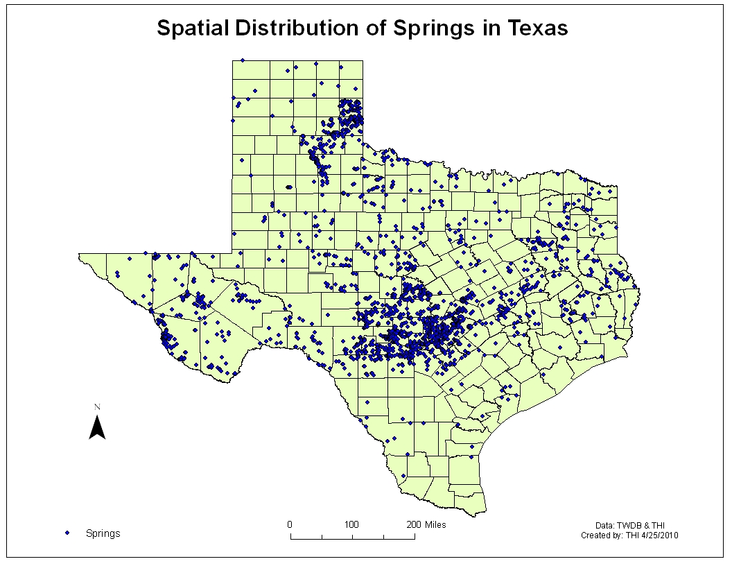 THI map of natural springs in Texas
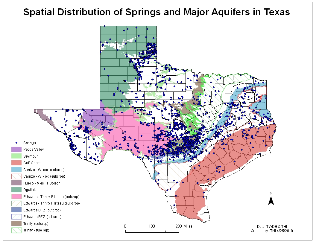 THI maps of aquifers and natural springs in Texas
Data
THI Comprehensive Database- Zipped Shapefile
THI Comprehensive Database- KMZ
THI Spatial Database- DBF Excel
THI Discharge Database- DBF Excel
Texas Water Development Board (TWDB)
United States Geological Survey (USGS)