JeoJays Consulting
Summary
The Christmas Bird Count (CBC) has been a tradition for birders with the Audubon Society for almost 110 years. It is a chance for the scientific community to team with volunteers to acquire information on the prevalence of bird species and populations in various regions. Birds are an important indicator species to a whole slew of human-environmental factors such as habitat fragmentation, food or water shortage, and pollution levels. The Westcave CBC Circle managers would like to consolidate their data from CBC years 2003-2013 into a digital tabular dataset that will be used for calculating migratory patterns and population fluctuations. The GeoJays also have the opportunity to add a spatial dimension to this data using Geographic Information Systems (GIS) to record where these birds are being seen, specifically within Westcave Circle CBC.
Purpose
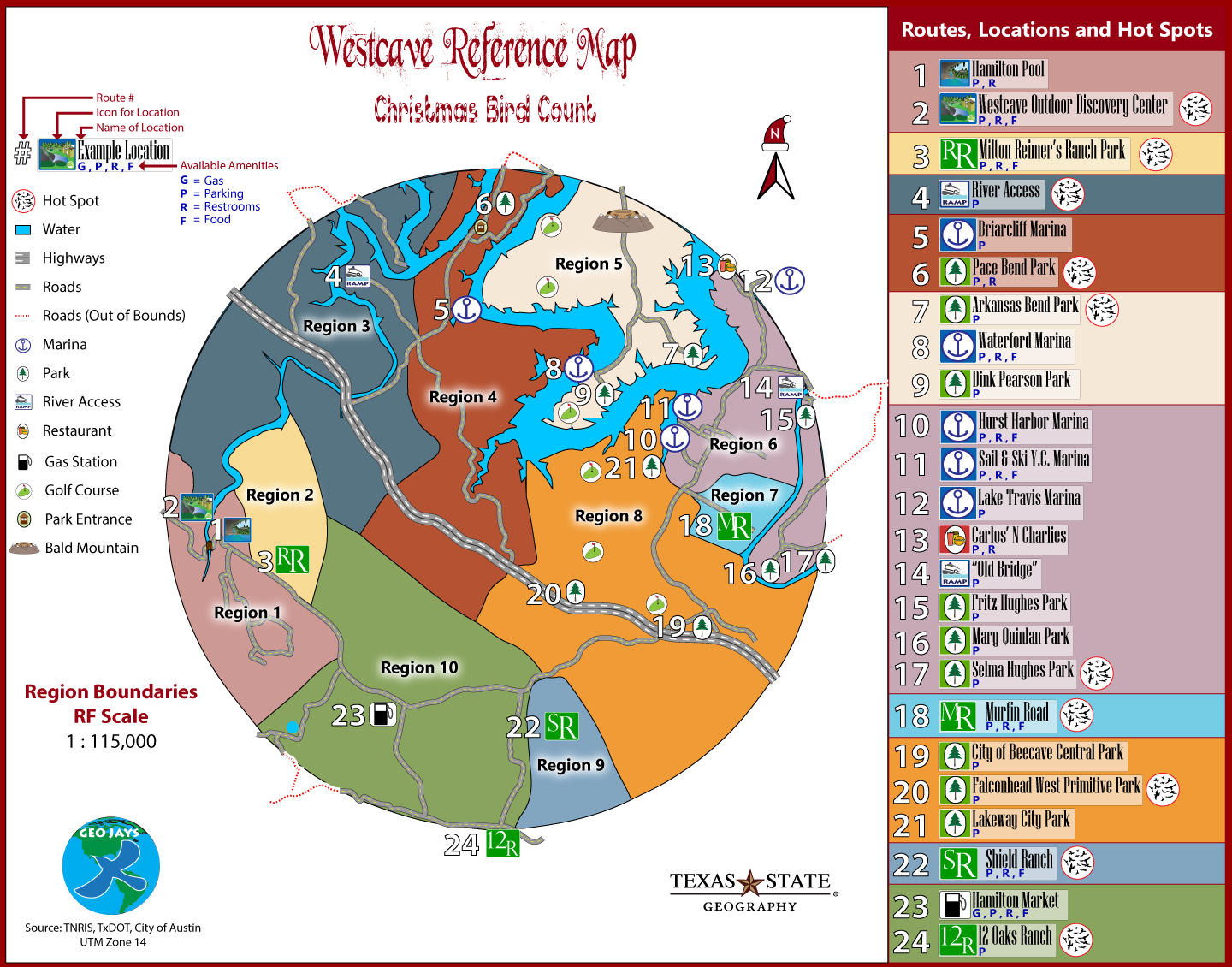
The purpose of this project is to raise participation and awareness of avian conservation efforts for the WODC by providing its staff and volunteers with reference maps. Our objective is to produce user-friendly reference maps of each region, and an overall map with delineated boundaries and comprehensive bird count totals for the past ten years.
Methods
Task 1: Input bird count information from hardcopy format to digital tabular format
Task 2: Digitize Westcave Circle from center coordinate, and delineate the ten region boundaries within
Task 3: Connect comprehensive bird count data for years 2003-2013 to Westcave_Circle.shp and respective region counts for ten years to Regions 1-10.
Task 4: Import GIS into Adobe Illustrator and trace road and boundary features to create a reference map
Task 5: Process spreadsheets to discover and graphically represent significant population fluctuations among bird species groups
Task 6: Create symbols requested by client, and import into reference map to create feature representations
Task 7: Organize, document, and deliver data to client and instructor
calculator.
Conclusion
Our mission to contribute to the WODC’s education and conservation efforts was accomplished. As the GeoJays became aware of potential inconsistencies in data collection methods the primary objective shifted from data analysis to improving data collection capabilities. Integrating a systematic method for recording bird sightings will enrich volunteer conservation efforts and illustrate geospatial patterns. Contributions to the Westcave Outdoor Discovery Center are possible due to the support of our client. Our client’s volunteering efforts provided ten years of data collection that are essential to the framework of the Westcave GIS.
Westcave Map