Project
Purpose:
- Create a GIS for GBRT
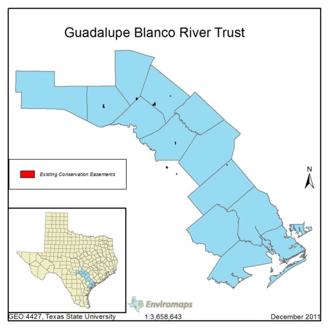
- Map current land easments of the GBRT
- Find potential suitable habitats for the whooping crane
Our goal as Environmaps is to assist the Guadalupe-Blanco River Trust by creating a database that will be efficient for further studies of the area that is being protected. This database will be able to be expanded as the study area grows and more conservation easements are acquired. The extinction of whooping cranes could be imminent without the help of groups such as the GBRT and as a part of our philosophy Environmaps’ objective is to help enhance the quality of life through Geographic Information Systems. With the map of areas that could be attained for easements we would have contributed to the survival of the whooping crane.
Scope
Methodology:
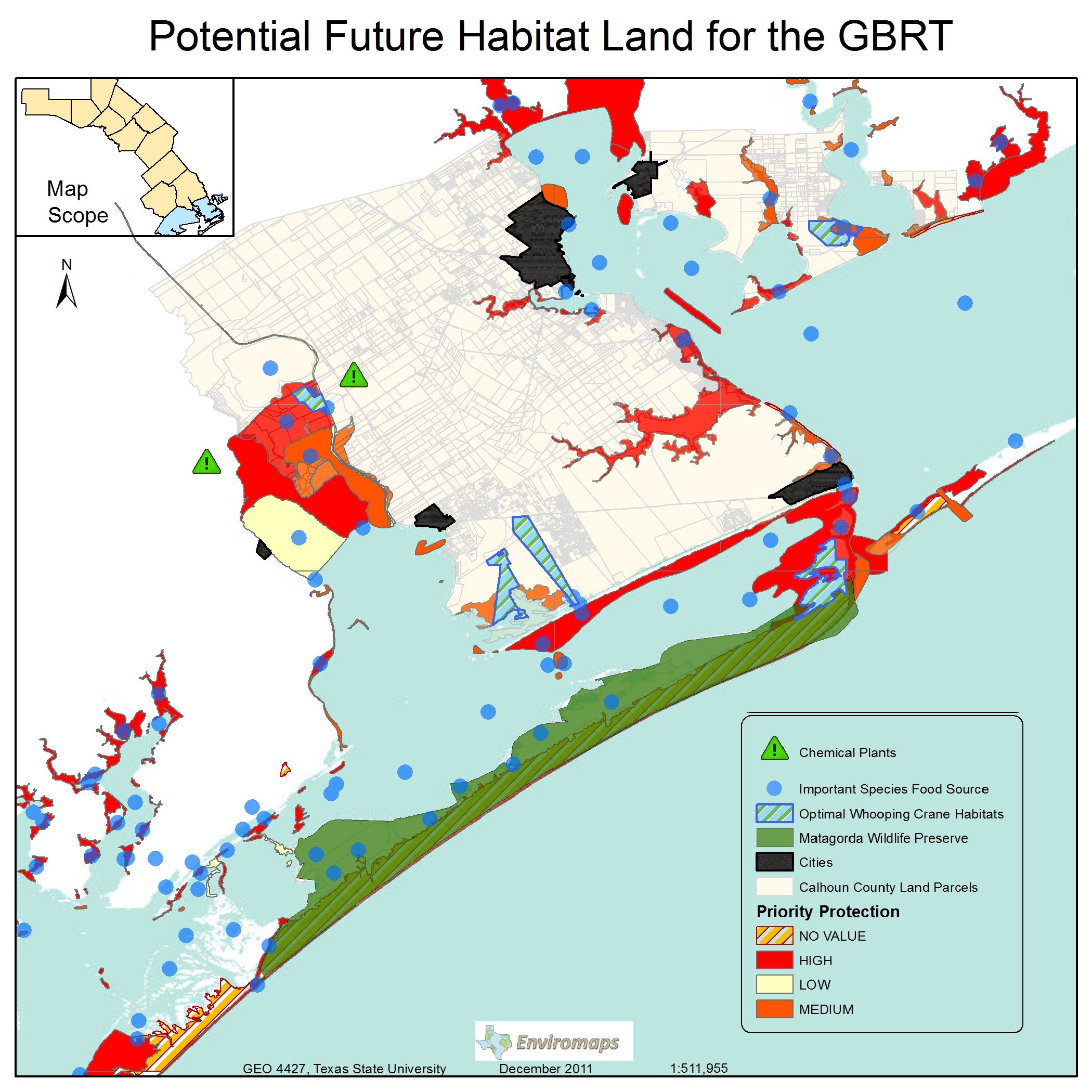
The Extent of the GBRT covers a 13 county region, however when dealing with finding posible habitats for the whooping crane, we focused on Calhoun coastal area. To find these habitats we used a locational analysis model that consisted of numerous factors influencing the whooping crane. Factors we based our analysis included
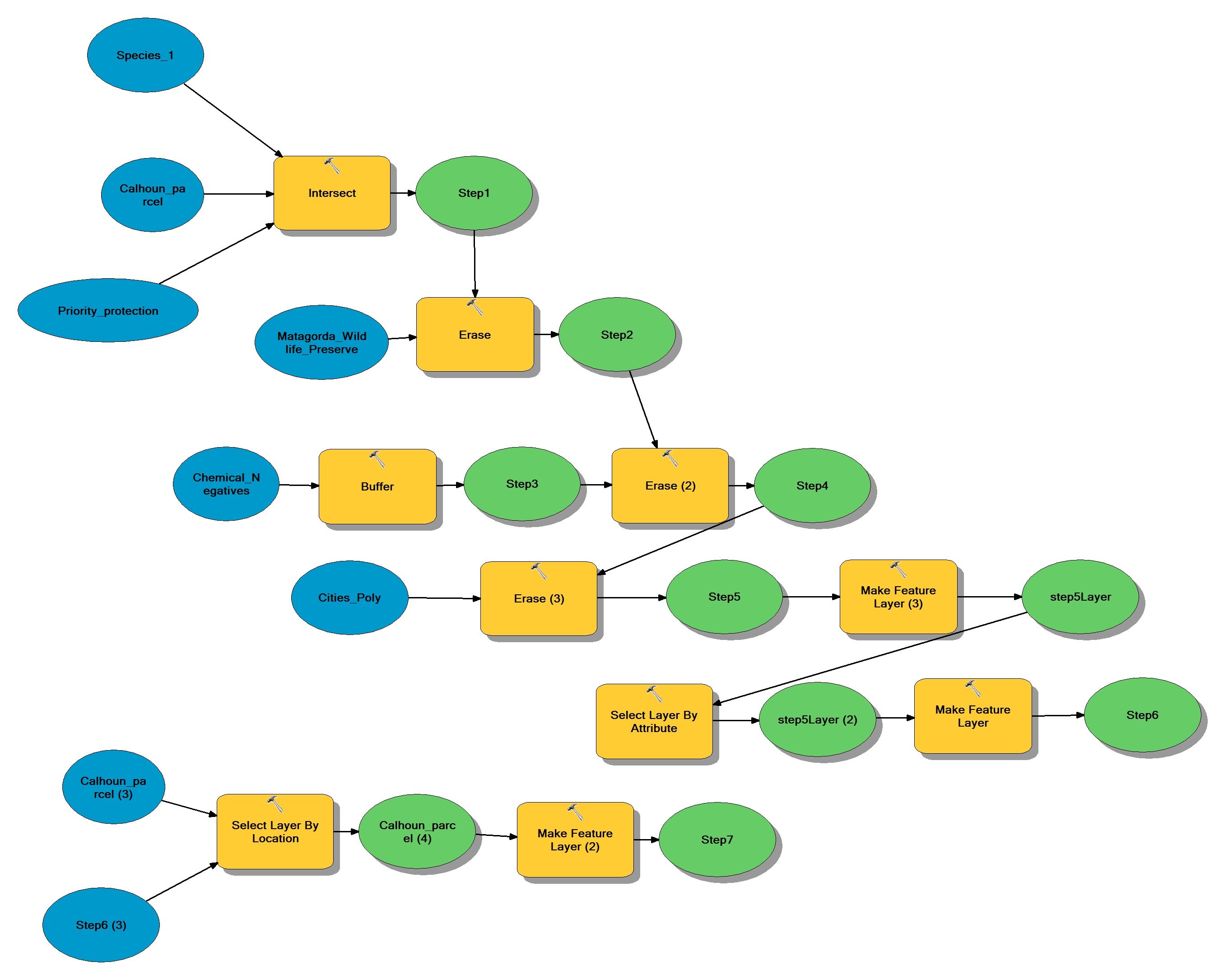
Our Analysis Model can be seen here:
(Click to enlarge)
Results:
Blah blah Blah blahBlah blahBlah blahBlah blahBlah blahBlah blahBlah blahBlah blahBlah blahBlah blahBlah blahBlah blahBlah blahBlah blahBlah blahBlah blahBlah blahBlah blahBlah blahBlah blahBlah blahBlah blahBlah blah