Maps
Manifold Interactive Map
*Click Here*
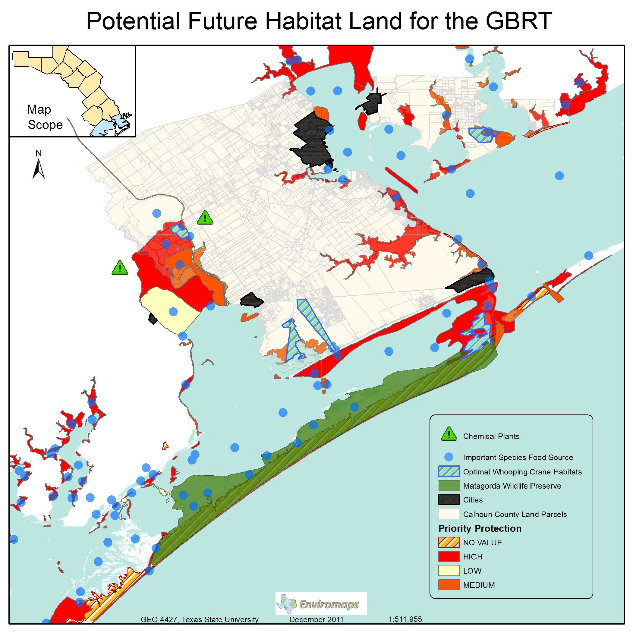
This is a fully interactive map showing Environmaps proposed locations of possible whooping crane habitats, and some factors we used to find these locations.
Click Maps To Enlarge
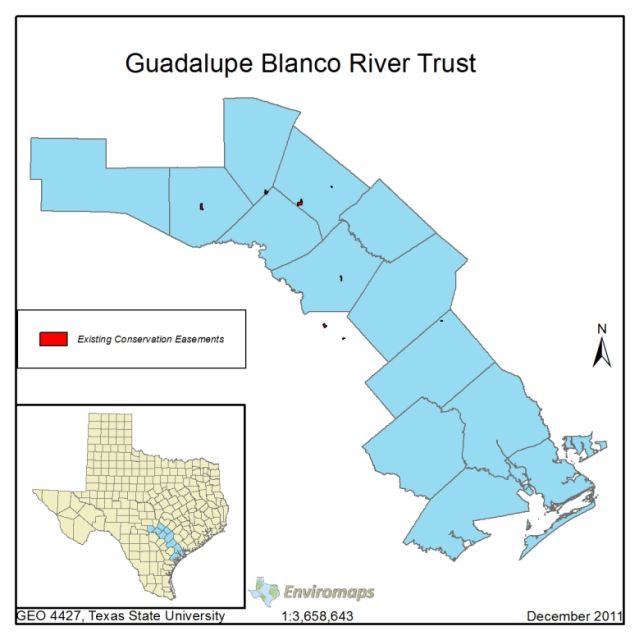
Scope Map: Shows the entire 13 county scope of the GBRT's study area.
Intermediate Analysis Map: This map shows our hierarchy of finding suitable areas, from the base potential areas we started with, and narrowing it down as we include certain factors such as location to cities or proximity to harmful chemical plants.
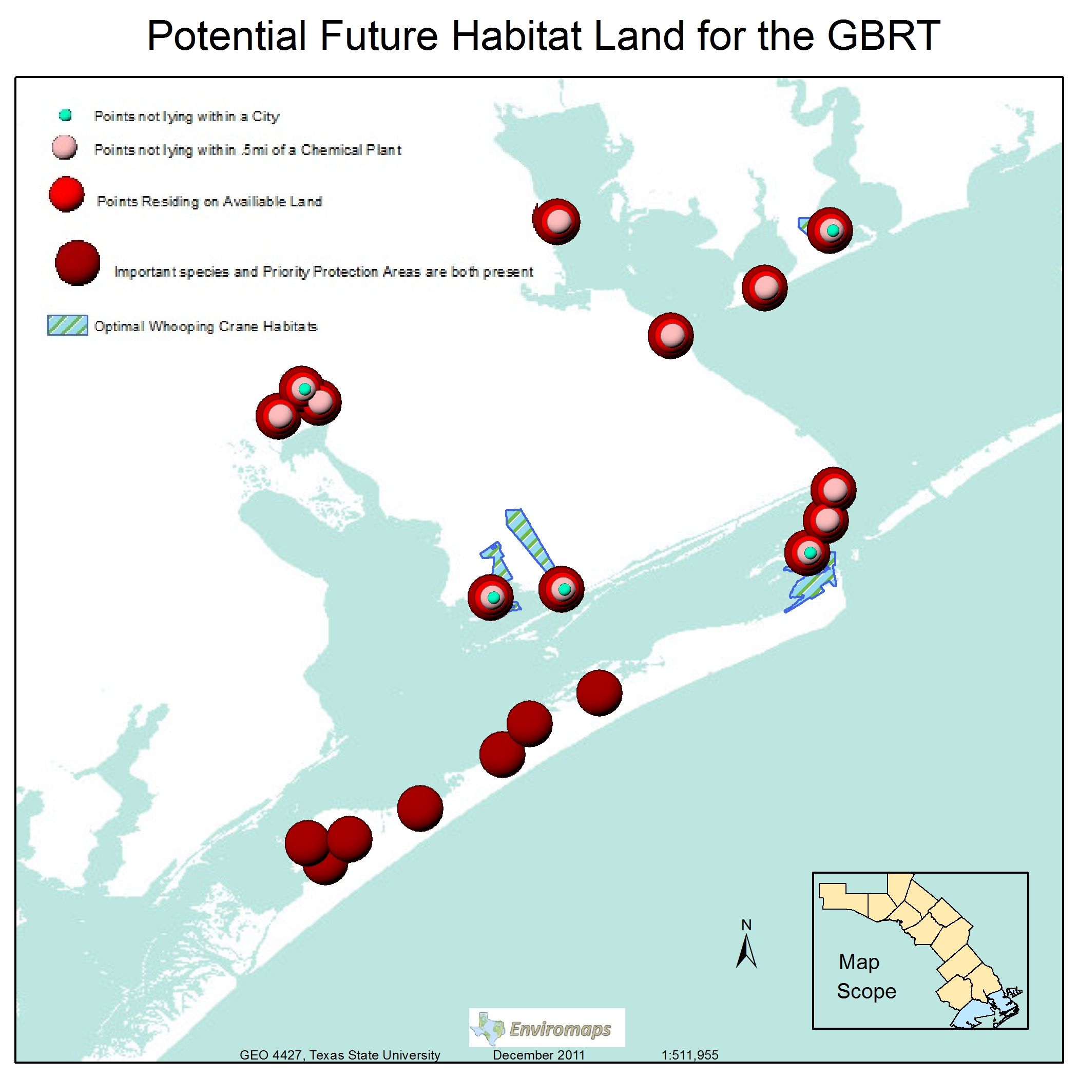
Final Output Map: This final map highlights our three proposed areas we found, as well as priority protection areas and cities