
Wildfire Evacuation Route Planning
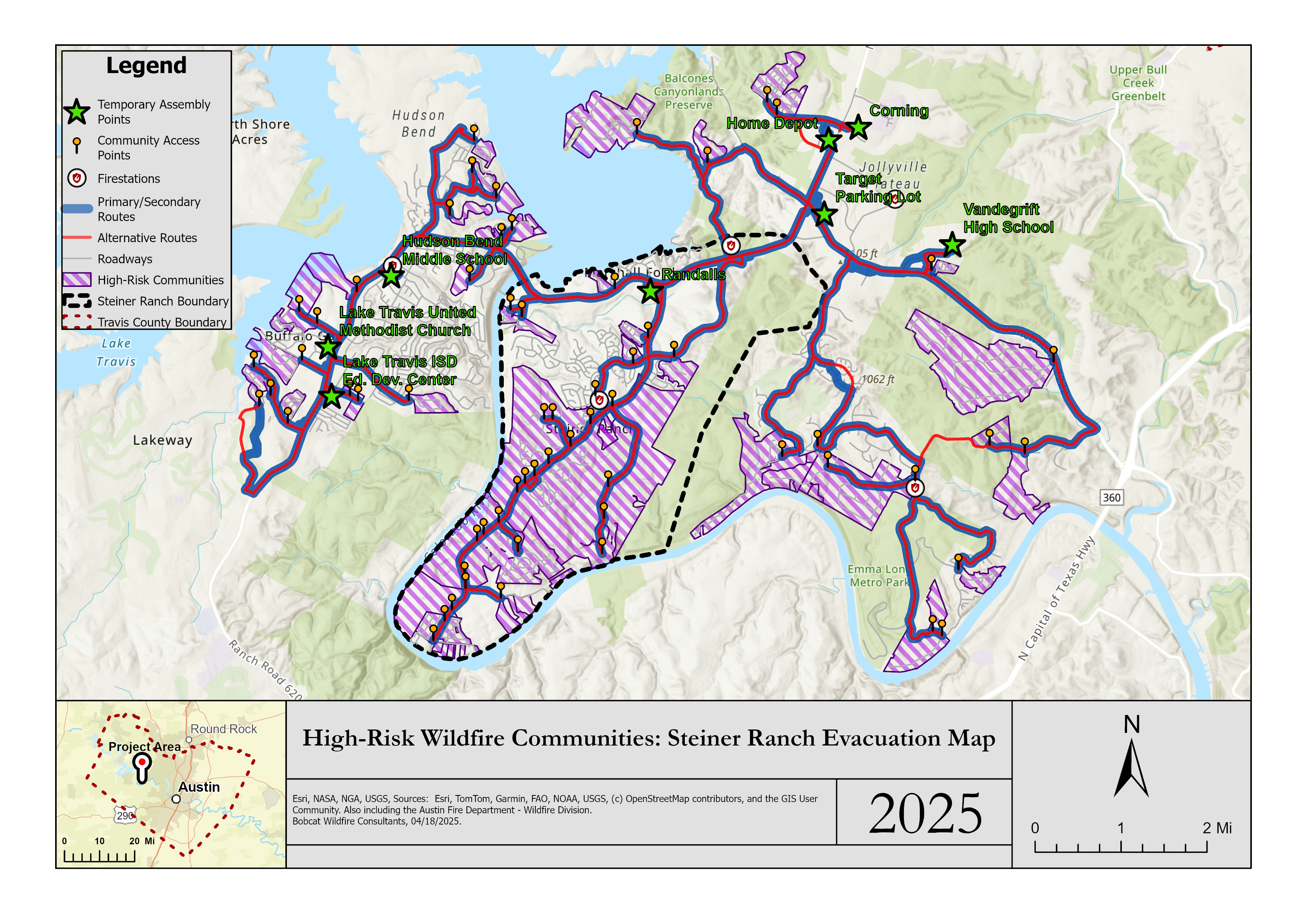
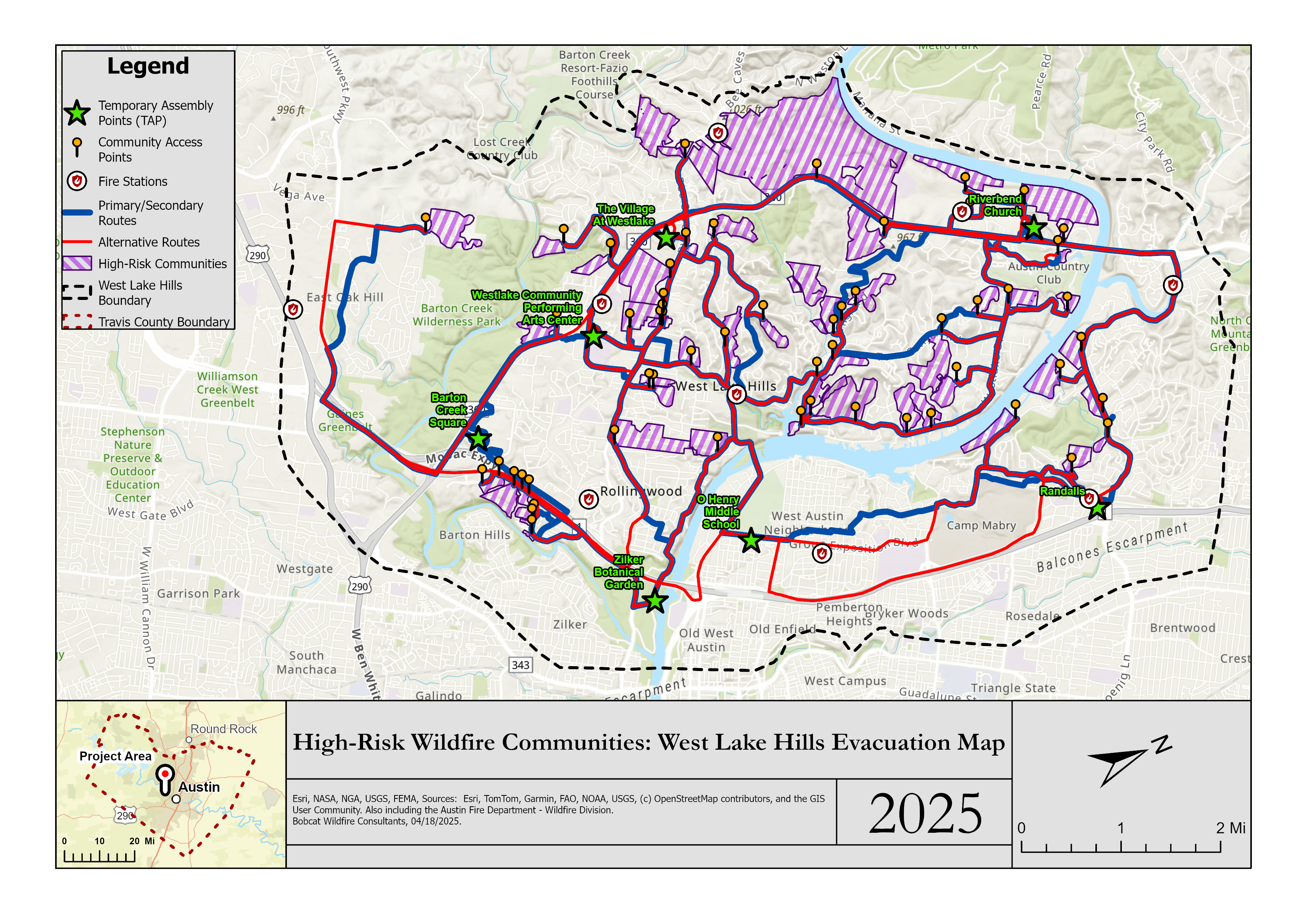
Our project focused on wildfire evacuation route planning for high risk communities in Travis County, Texas. We were provided three shapefiles from the Austin Fire Department Wildfire Division that included ingress and egress points, Temporary Assembly Point (TAP) locations, and community polygons identified as wildfire prone. Our team, Bobcat Wildfire Consultants, expanded and modified these datasets and ran a series of network analyses using ArcGIS Pro to create four evacuation routes for each at-risk community: two based on distance and two based on time.
Team Members
Dawson Speer - Project Manager
Hank Hall - GIS Analyst
AJ Carter - GIS Analyst