Urban Tree Canopy Vulnerability Index For Austin, Tx
Summary
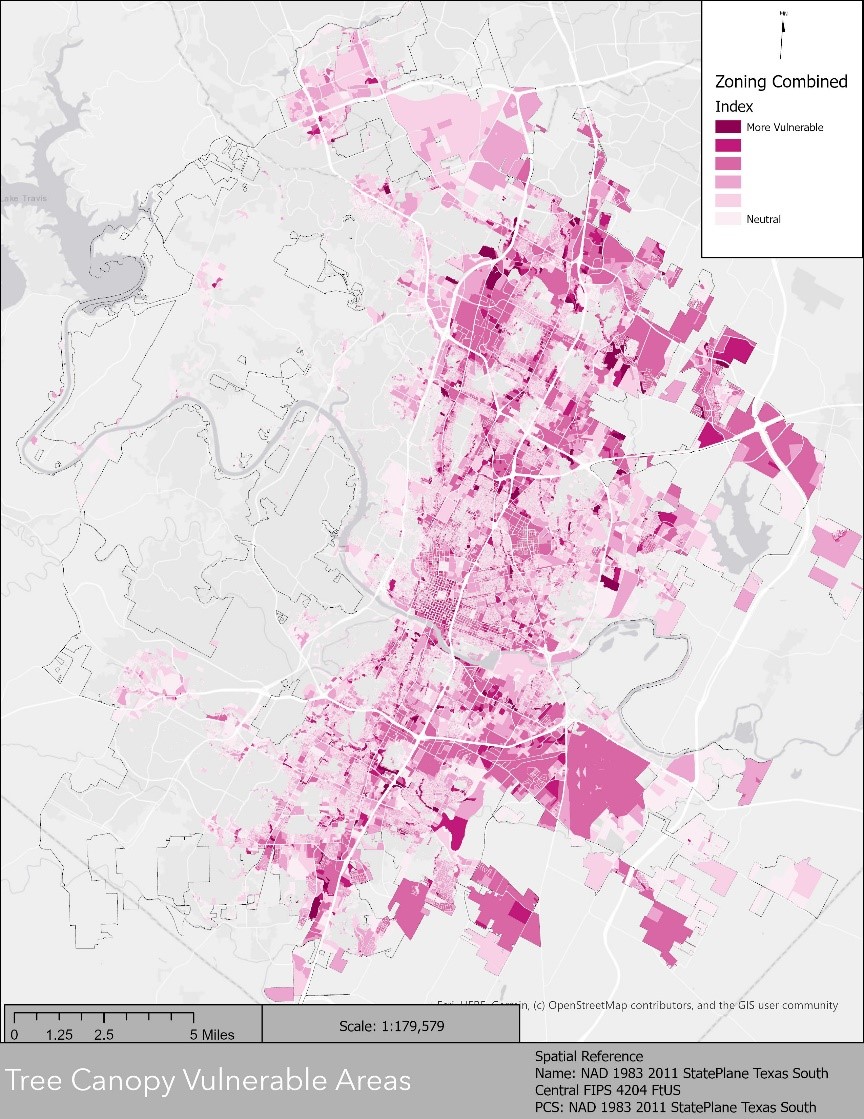
This project was to create a tree canopy vulnerability index for the city of Austin, Tx. This was done using data provided by the city in the form of environmental constraints and zoning data. By creating a weighted matrix designed from the ground up through research and literature review with a scale of -5 to 5. Once created and weights applied to the proper variables, this was summed up to create a final vulnerability for the city of Austin
Methods
To create the vulnerability index, we clipped and intersected all our data into Austin’s full jurisdiction. Once the data was organized, we converted the previous tree canopy file from a file into a vector. From there, through research and literature review, we determined weights for each of our environmental constraint variables as well as weights for any city zoning data provided. We then calculated the percentage of these variables within every parcel within the city. Fields were then created, and weights added to each variable. Once everything was weighted properly. We created one more field, added them all together to create our vulnerability index
Conclusion
Looking at the tree canopy cover within Austin, we can see that tree canopy looks to be more vulnerable in the East compared to the West. There is also an interesting change within tree which occurs right when crossing I-35 on either side as it looks to be a major point of change within canopy cover. With the cities urban landscape expanding rapidly, canopy cover needs to be considered as trees have a large impact on the city from an environmental and financial standpoint.

Tree Canopy Vulnerable Areas