Examining the Relationship Between Urban Heat Islands and the Tree Canopy in Austin, TX
Summary
The urban tree canopy (UTC) can have many benefits including shading the city's landscape and reducing thermal radiation. When there is not enough canopy to shade the urban surface area, thermal heating can increase creating urban heat islands (UHI) where the temperature of the city is warmer than the surrounding rural region. Urban Heat Islands can impact the local weather by decreasing wind and precipitation, cause health problems, and increase energy usage. Specific parts of the urban area may also be hotter than others. These warmer locations may have a less dense tree canopy or no canopy compared to other parts of the city. The relationship between the Austin UTC and the city's UHI is what our team analyzed and measured.
Purpose
The purpose of this project is to analyze and map the relationship between the UTC and the thermal radiation of the Austin city center within Travis County. Our analysis can be used by local planning and urban foresters to reduce the effects of UHIs in Austin, which include suggesting areas to plant more trees. By reducing the effects of UHIs city wide, Austinites could see their energy usage decrease and their health during the summer improve.
Methods
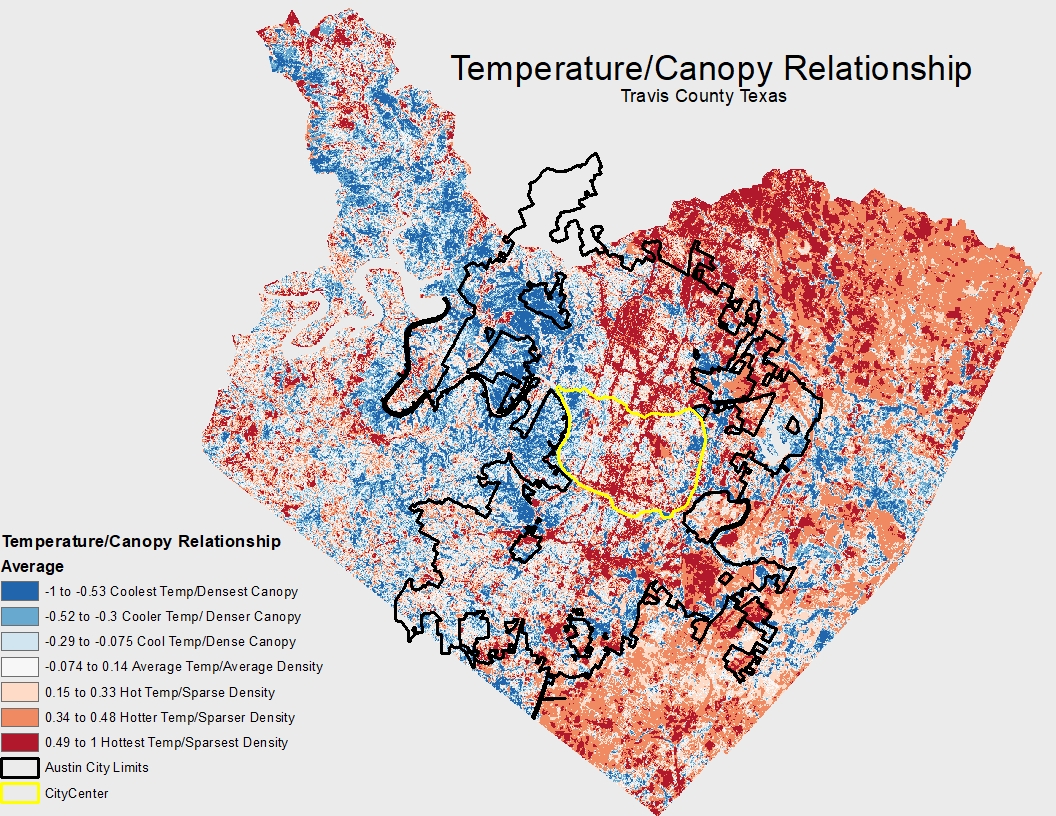
Landsat 8 thermal imagery data of Travis county from 2014 was processed to find the average summer time land surface temperature. UTC data of the greater Austin area was processed into a raster of canopy density at the same resolution as the LST, which was around 100 feet by 100 feet. The LST values and UTC density values were processed by a relational value analysis. The final results showed city parcels in a spectrum with warmer LST and low canopy density, parcels with cooler LST and high canopy density, and all LST and UTC values in between.
Conclusion
By using LST and UTC methodologies and analysis, we confirmed the correlation between Austin's UHI and the UTC. During the summer of 2014, areas with sparse tree cover were very likely to have high temperatures and areas of dense tree cover were very likely to have low temperatures. Furthermore, were able to create methodology tools that can be utilized by the City of Austin in the future. This will help them locate UHI problem areas to make informed decisions where to plant more trees or implement other ways to mitigate heat islands.
Temperature/Canopy Relationship