Spatial data is a powerful tool when made easily accessible. In our application we use layers created by Texas parks and wildlife to create a geolocator tool for public use. The primary spaces included are Federal, state and San Marcos local trails. Public spaces are often difficult to locate and utilize on a case-by-case basis. So, we wanted to provide a tool that gives users easy access to each park's website. Making use of CSS, JavaScript, and HTML we set out to make public spaces in Texas easier to find and utilize. Our application can be boiled down to three main components. First being the base map provided through ArcGIS API. Second, the georeferenced data found through Texas Parks and wildlife. Finally, a geolocator tool that uses the above-mentioned data to give users the 9 closest green spaces to a specified location. The result is a simple yet effective way to find information about the nearest parks to a designated spot. This can be used with the current location or when planning a trip to a new area.
![]()
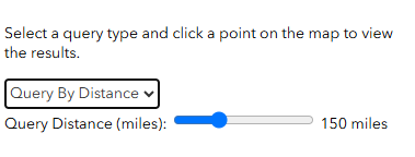
Our map tool is easy to use! Firstly, select on the left side of the Home page if you would like a "Basic Query" or a "Query By Distance". A "Basic Query" is good for locating information on a specific site, while the "Query by Distance" option allows for a larger number of entires!

Then using the map box, scroll and left click and hold to pan the map find a location you're interested in!
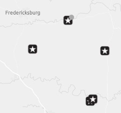
Next, simply left click onto the desired location in the map box to place a marker.
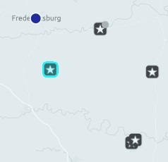
Now, a interactive query box will appear on the bottom right of your screen. The box will automatically display the parks via distance from the point.
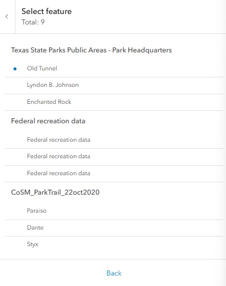
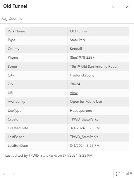
After left clicking on a park you will be able to see further information. Such as: County, City, Zip Code, Address, and a URL linking to its park website.