Bull’s Eye GPS & Suitability Services
Summary
The San Marcos City Cemetery, founded in 1874, is located on 45 acres at 1001 Ranch Road 12 in San Marcos. The cemetery is the burial ground for many Texas pioneers and veterans of wars dating back to the War of 1812. The cemetery lies within a Mexican land grant acquired by Thomas Chambers in 1834. Chambers died in 1865 and in 1867 his widow, Abbey, sold 3,000 acres containing this site to H.N. Duble at an estate sale held in Galveston. A portion of the cemetery site was purchased by Freedman Peter Roberts in Galveston in 1868. It’s also believed that there were slaves buried at this site from the earliest settlers making it a very unique burial ground containing soldiers of war, pioneers, Native Americans, and the local population of San Marcos that has resided in this community for the past 150 years.
Purpose
The purpose of our project is to digitize the tower addition of the cemetery as well finding a proper location for a new telecommunications tower. Our work will be used for integration into a software program known as Pontem, Pontem is a cemetery management software system that was developed for maintaining all of your cemetery’s grave, owner, burial, and genealogical records. This project will give the citizens of San Marcos and abroad a user friendly interface to check their cemetery records as well as a fully scalable map with aerial imagery, web publishing, including their online burial search. With the new location for a LCRA tower identified, the city and larger Hays County and Comal County area can have improved first response aid in emergencies.
Methods
GPS reference points collected every 50 or so feet around the perimeter of the tower addition section to get an accurate georeferenced study area.
Gathered points for individual block sections for sizes 4 and 8.
Using individual block measurements as framework for editing and copying of polygons for the rest of the blocks needed for the tower section.
Created triangular irregular network using contour lines, which was converted to a DEM.
After a DEM was developed, the visibility tool was used to see the potential visibility on a 5 miles radius from the two different locations.
Conclusion
In conclusion, we believe we gave the San Marcos Cemetery accurate data to work and integrate into Pontem as well as a proper analysis of the new tower addition location determination. Overall the project tested many skills that are to be used in the workplace. The most challenging part of this project was the operation of the GPS unit. However, continuing to work with our client helped the learning process and was crucial to the time table we were given to complete this project. We hope to this project comes of use to the citizens of San Marcos going forward.
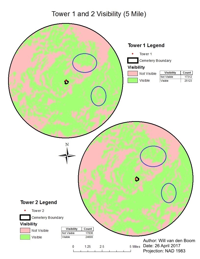
Tower 1 and 2 Visibility