
Trailblazers Consulting
Summary
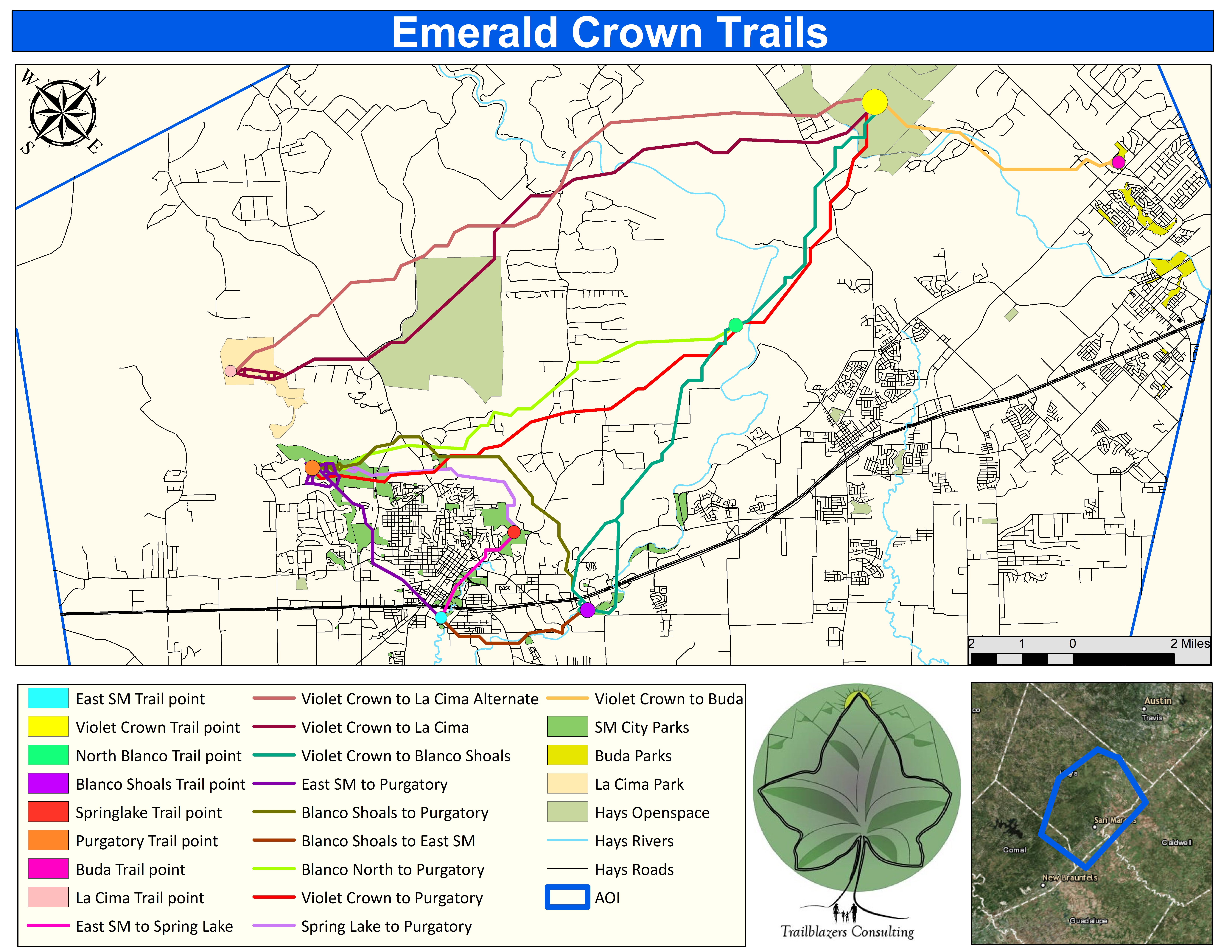
The San Marcos Greenbelt Alliance (SMGA) is a non-profit organization founded in 1998 to provide non-motorized travel throughout San Marcos and other communities. Currently there is no direct access from San Marcos to Kyle for pedestrian traffic. Creating a passage between the two growing cities will allow citizens to hike safely between locations.
Trailblazers Consulting will implement a GIS that will provide the San Marcos Greenbelt Alliance (SMGA) with the most sustainable route for a connecting trail from San Marcos to Kyle. With this proposed route, the SMGA plans to connect with other communities such as the City of Buda and Austin. They intend to develop a route connection with Austin's Violet Crown trail that is proposed to link the cities involved between San Marcos and Austin.
Purpose
This study will provide a GIS of a proposed greenbelt trail from San Marcos to Kyle based on the analysis of multiple criteria: property ownership, land usage, tree cover, established trails with possible connectivity, and potential crossings of major highways and rivers. We will classify our criteria as either desirable or undesirable and manipulate the trail route accordingly. This will create a spine trail with little to no difficulty to traverse so anybody can easily and efficiently travel between these cities without having to drive a motor-vehicle.
Methods
This project will be produced using data from the stakeholders which are: the City of Kyle GIS department, San Marcos GIS department, and the City of Buda GIS department. Other data sources we will use will be from Texas Natural Resource Information Systems (TNRIS), Google Earth, and the United States Geological Survey (USGS) for the development of the trail.
Conclusion
TrailBlazers Consulting will use the data provided by the San Marcos GreenBelt Alliance and other stakeholders, to develop a trail from the City of Kyle to San Marcos based on the analysis of spatial data. The functionality of the GIS will be to provide a path of least resistance based on the criteria set to develop a trail that will be suitable for pedestrian travel between these cities.