Rand-Green-Sibley Consultants: Environmental Analysis Solutions
Summary
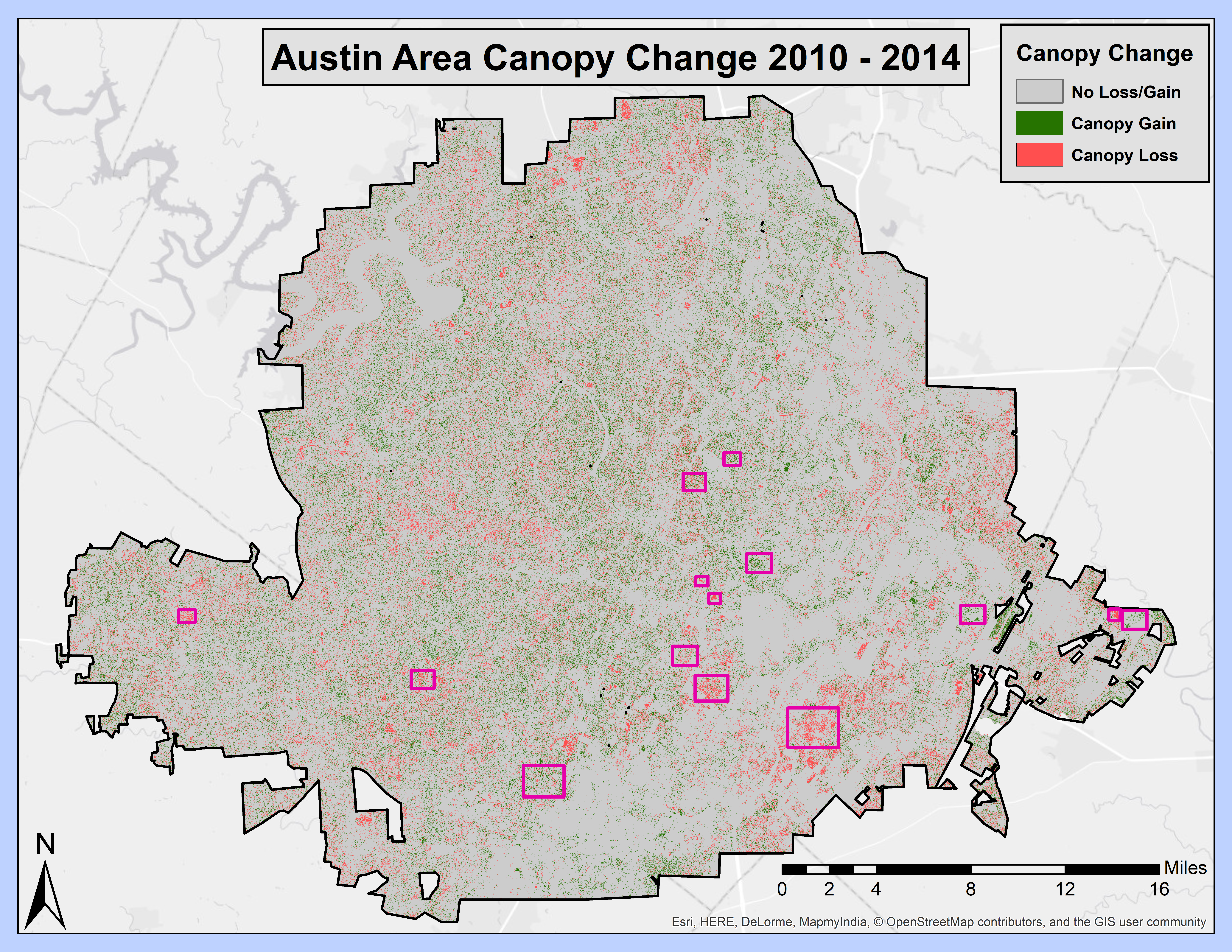
Widespread deforestation, particularly in sensitive ecosystems such as the rainforest, is a well-known and extensively discussed topic. However, there is one lesser-known type of deforestation that is very sparsely studied, and yet, grows exponentially with the spread of metropolitan sprawl: the phenomenon of urban canopy loss. This semester, Rand-Green-Sibley Consultants has worked with the City of Austin Urban Forestry Program to evaluate urban canopy change between the years of 2010 and 2014 using aerial imagery of canopy cover. This study uses raster overlay of canopy cover between 2010 and 2014 to compare the change with features such as land use data, political boundaries, and watersheds. This study discusses the potential relationship between canopy change and the aforementioned features. Using this information, we recommend priority areas for tree planting and distribution programs. We represent the study findings in standard map form, and additionally we have created a story map using ArcGIS Online to demonstrate this change interactively, which is intended to be used by the City of Austin for urban forestry advocacy.
Purpose
The aim of this project is to highlight areas of greatest canopy loss and gain, and use this information to tell a meaningful story of the canopy of Austin over the past decade.
Methods

Conclusion
The results from our analysis highlighted a number of critical areas for canopy loss, and suggest explanations for these phenomenon. The results of this study will not only aid the City of Austin Forestry Program, but contribute to the study of the correlation between urban forests and anthropogenic actions. This knowledge will allow the City of Austin and other urban canopy advocates to take action more efficiently, as well as guide programs to mitigate issues that might contribute to the loss. In addition, our story map can now be utilized by the City of Austin as a visual and educational aid.
Austin Area Canopy Change 2010 to 2014