Pollution Solutions
Summary
San Antonio is a major city in Texas, drawing in many new residents, visitors, and development plans each year. With the cities rapid growth, it is essential to ensure that the health of all waterways are maintained. This is where The San Antonio River Authority (SARA) plays a vital role. The SARA manages over 3,600 square miles of waterways, spanning over a total of four counties. Overall, the goal of The SARA is to maintain the health of waterways through education, outreach, and protection.
Purpose
The SARA has reached out to Pollution Solutions to implement a GIS to locate areas of high pollution production along Westside Creeks, located in Bexar county. Identifying areas that are contributing to pollution can help reduce the amount of waste spilling into San Antonio waterways, as well as identify where the main sources of pollution are coming from.
Methods
Based on the provided data, Pollution Solutions determined the best way to pair inlets with their respective outfalls was to delineate the total area flowing into a given outlet based on the digital elevation model (DEM).
Task 1: Preparation of data provided by The City of San Antonio and The San Antonio River Authority, ensuring to remove data falling outside of the project boundary. Line data displaying all Westside Creeks was also essential to create, as it was the main area of focus.
Task 2: Delineation of a watershed was conducted for each outfall by running the fill, flow direction, flow accumulation, and snap pour point tools. Using the watershed tool, new polygon layers were created to represent the sub watershed boundaries that contribute to the Westside Creeks.
Task 3: Final maps were created to show which inlets contribute to a specified outfall. If The SARA wishes to expand this project to other areas in San Antonio, the created cartographic model can be used as a visual reference.
Conclusion
Conducting a watershed analysis takes into account the natural flow of the landscape, as well as where water accumulates. Therefore, this analysis will help The SARA identify which inlets lie within a pollution source, as well as how far down that pollution source can travel. The SARA can utilize this analysis for other sections in San Antonio. Due to the city of San Antonio’s rapid growth, locating areas that are contributing to pollution is vital, and Pollution Solutions hopes this project can help narrow down where pollution is originating. Doing so will improve the accessibility of waterways, not just for recreational use, but also for the natural ecology that exists.
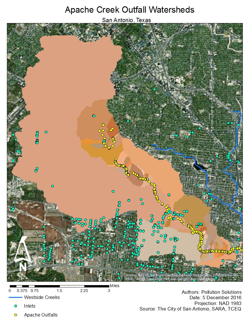
the inlet points and watershed areas of Apache creek