Summary
DeWitt County is a small rural county in South Eastern Texas containing 4 major towns and holding an estimated population of 20,500 throughout the entire county (DeWitt County Profile, 2013). Due to the Eagle Ford Shale phenomenon in DeWitt County, there have been huge concerns for chemical fires endangering people, property and the environment. The term 'Eagle Ford Shale' refers to the town of Eagle Ford, Texas, 'where the shale outcrops at the surface in clay form' (Eagle Ford Shale, 2015). It is the 'largest oil & gas development in the world based on capital invested' (Eagle Ford Shale, 2015). To augment the chemical risks involved, the county uses seven volunteer fire departments spread over 910 square miles to respond in emergencies (DeWitt County Profile, 2013). Much of the county is without internet, and cell phone coverage is not the best, so being able to communicate and navigate in an emergency is of high priority. This spring of 2015, our team South Texas Emergency Consulting, will build a guide book using GIS data to aid response teams in an emergency. The guide book will be distributed to all response teams across DeWitt County. It will assist emergency responders with the ability to communicate with facility managers and give proper information on equipment and protocol in case of a chemical emergency.
Purpose
The objective is to create a guide, independent of the internet, to be distributed to emergency response agencies within DeWitt County. The hand book will contain GIS information of facilities holding extremely hazardous substance (EHS) materials and hydrocarbons (H2S). The guide will include: maps and information on gate access, calculated safety zones with road block information, a list of contacts, notification procedures, a list of hydrocarbons (H2S) and other hazardous materials on the premises, and protective actions to be taken in the event of an emergency.
Methods
The facilities will be separated out according to EHS and hydrocarbons and buffer zones created indicating safe distances in an alert 1or alert 2 phase emergency. To ensure the successful implementation of emergency procedures in the case of a potentially catastrophic chemical release incident, the reference guide maps must:
- Include current and complete contact information of necessary personnel, gate access information/location, and visual identification of gate access
- Clearly display threat zones for each facility holding EHS chemicals and/or hydrocarbons
- Clearly display all other chemical-holding facilities within a given threat zone
- Display EHS chemicals within facilities
Conclusion
This project will create a product that will be very beneficial for the communities within DeWitt County and for the emergency responders who protect them from harm every day. By creating this guide we can help them do their jobs to the fullest extent. It is a pleasure and an honor to our group to be allowed the opportunity to make an impact with this project. Nothing is better than when you know the work you are doing will be helping improve the lives of other people. We hope to make the responders feel more comfortable responding to chemical spill situations than they would have without our handbook at their disposal.
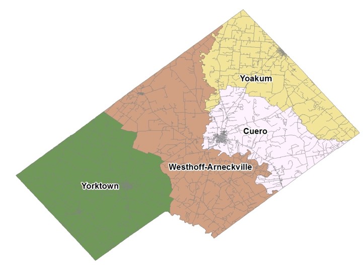
DeWitt County