


City Limits |
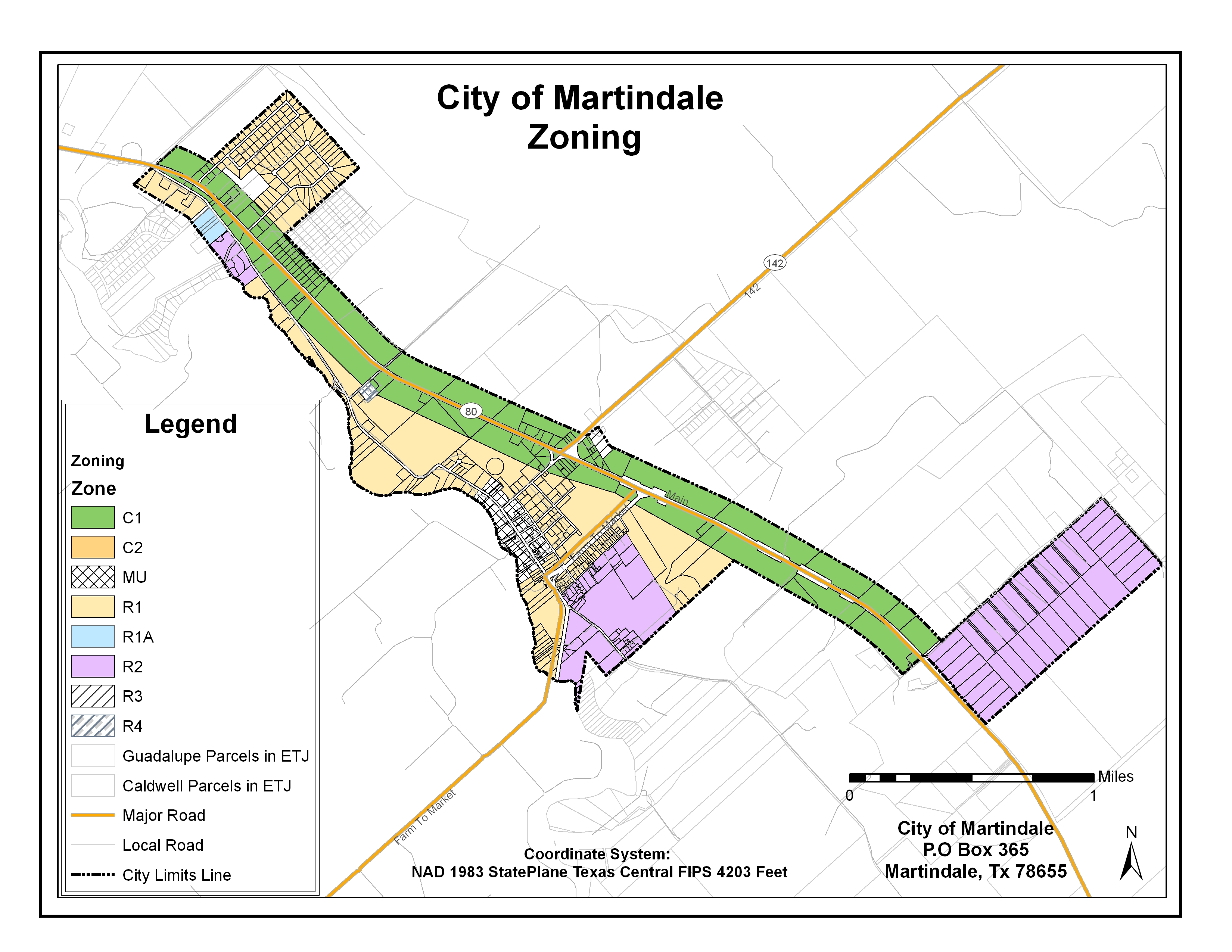
Zoning |
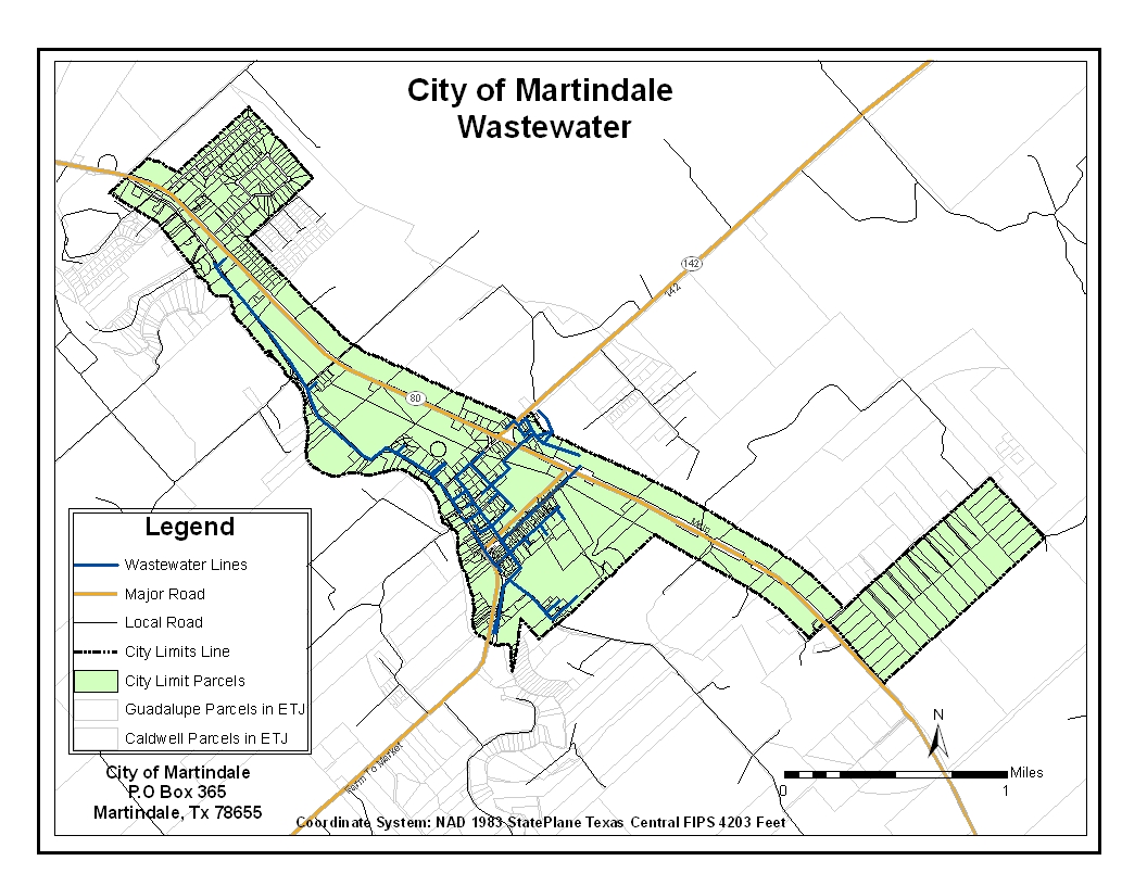
Wastewater |
ETJ |
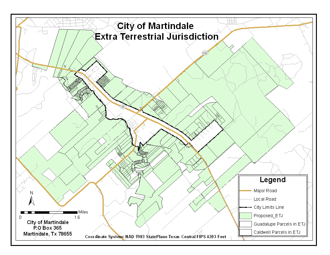

The creation of a proposed ETJ was a major concern for the city. Central Texas has been rapidly growing in the past years and will continue to grow in the future. The City of Martindale needs to be sure they can independently maintain themselves without getting swallowed up by the more rapidly growing surrounding cities. Many land owners, from both Caldwell and Guadalupe County, requested admittance into Martindale’s ETJ as to remain a part of this historic city within a continually growing region. |
A wastewater system map is necessary to the future growth of The City of Martindale. This map allows the city to view their current infrastructure as well as giving them a base map to build from. As additional neighborhoods and businesses are developed the city can now view the different ways to connect the new wastewater lines to the already existing wastewater system. |
The City of Martindale is in the process of updating their current zoning policy. Policy updates are necessary to more accurately guide city growth and development to maintain the small town community that exists today. The GIS data as well as Google Earth files provided by Bobcat Planning will allow the city to update the zoning map as changes are made and the new zoning policy is finalized. |
Overlays and Stop signs: |
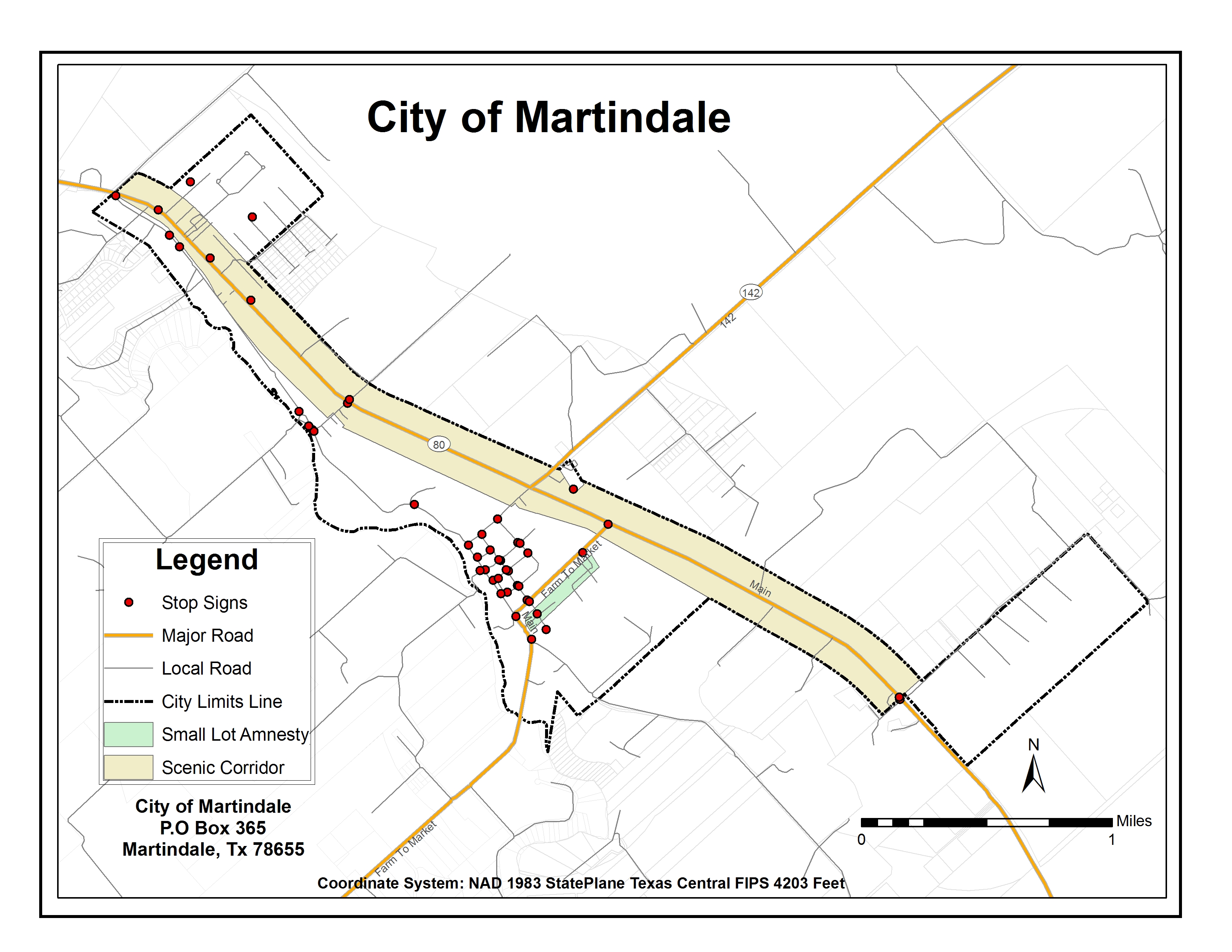
Two new zoning overlays were created due to a new zoning code that is now in place. In addition to updating the zoning code, the city is in the process of reviewing the stop sign ordinance. The digital map of stop sign locations will allow updates to be made as stop signs are added or removed. |