KMRS Consulting
Summary
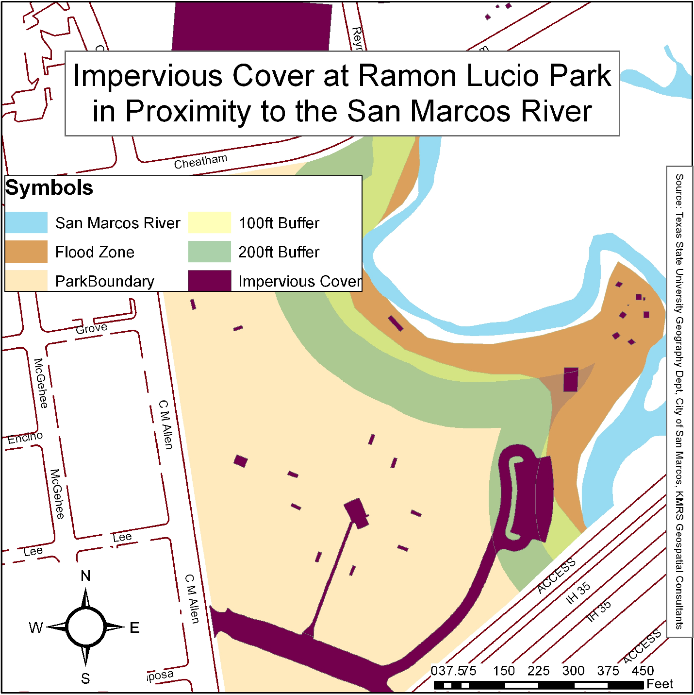
Ramon Lucio Park and Baseball Fields, encompassing an area of 22 acres, is located approximately 1.5 miles from the headwaters of the river in the City of San Marcos, Texas. The City of San Marcos, which has topped the list of fastest-growing cities in the nation for the 3rd consecutive year (Janzen and Beausoleil 2015) , is in the process of creating GIS inventories of city parks and green spaces, and proactively managing the sensitive ecosystem of the Upper San Marcos River, in an effort to grow the city in harmony with the nature in and around it. KMRS Geospatial Consultants, in collaboration with the Community Services division of the City Of San Marcos, will inventory over 30 different types of features at the property and create a geodatabase that will be used to reduce park maintenance cost, disseminate information to the public, and provide scientific analytics for sound ecological range management. In addition, our consultants will evaluate the existing impervious cover within the property boundaries and propose a course of action to mitigate imperious cover within park boundaries.
Purpose
This project will determine the spatial and attribute data of park amenities, such as grills, gazebos, and parking, and field layout, such as base plugs, dugouts, and illumination. This data will be used to create a geodatabase to model Ramon Lucio Park and Baseball Fields features. Additionally, previous data collection and file geodatabase architecture for Rio Vista Park will be evaluated and changed if needed. This will help the city make more efficient and informed decisions about future parks and recreation projects. KMRS Geospatial Consultants will then use data collected to evaluate existing impervious cover and propose a course of action to mitigate all impervious cover within park boundaries.
Methods
The main goal of this project is to create a geodatabase that will help the City of San Marcos make data-driven management decisions regarding parks and green spaces, such as the mitigation of impervious cover at Ramon Lucio Park. Initial tasks will include the evaluation of the geodatabase structure for a similar project previously carried out at Rio Vista Park. At this point, it will be decided whether the GDB merits modification, and apply any necessary changes. Next, our team will define the data dictionary required for field data collection. The major features to be mapped are: parking lots (polygons), trails (lines), dugouts (polygons), illumination poles (points), sprinklers (points) sewer (points), breaker boxes (polygons), maintenance equipment storage (polygons), sidewalks (lines), San Marcos River (polygon), and administration offices (polygon). Any other features will be added as necessary. All features will include a field named PARK_NAME that will indicate where the feature is located.
Conclusion
The dramatic increase in the population of San Marcos and other regional cities, combined with changes in legislation affecting land adjacent to the San Marcos River, have prompted the city to re-evaluate its parks and green spaces. After analyzing data from Rio Vista Park, provided by the city of San Marcos, and processing the data that KMRS will collect in the field at Ramon Lucio Park, our company will provide the City of San Marcos with a geodatabase containing features from both Rio Vista and Ramon Lucio Parks, a report listing the results of our assessment of existing impervious cover on the parcel, and a series of recommendations for the mitigation of impervious cover at Ramon Lucio Park.
Ramon Lucio Park Impervious Surface Map