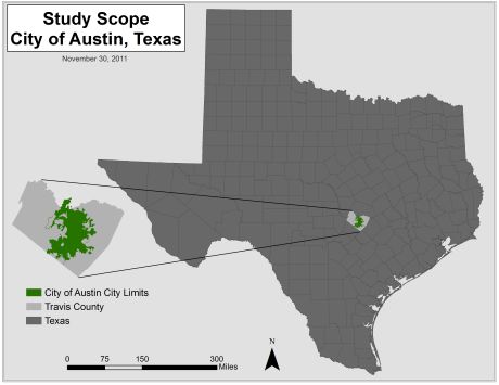
Purpose
The UFP is mainly interested in identifying the canopy strength in the city’s streets and multiple use trails that fall within the neighborhoods and watershed districts of the city. With this in mind, the overall purpose of the study is to identify the percentage of shade that the urban tree canopy provides to the streets and multi-use trails of the city neighborhoods and watershed districts. The percentages will provide the UFP with the information they need to further protect and maintain the Austin tree canopy as well as provide information on the areas where new trees should be planted and special attention should be paid. In addition, the streets have been segmented by city blocks and the multi-use trails are divided by the average trail length (which is one-eighth of a mile) per the UFP’s request.