|
Maps |
|
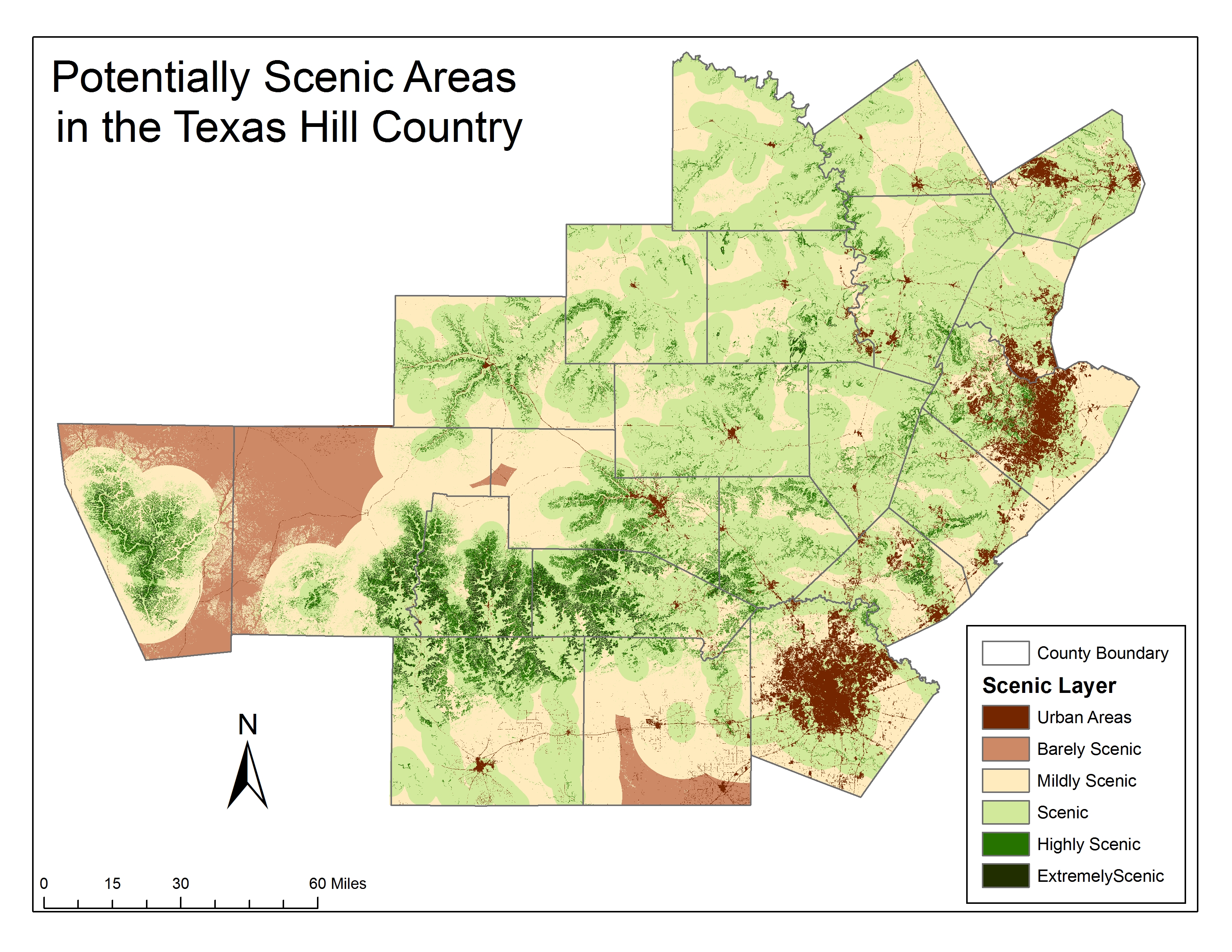
This is a map of the study region with the scenic suitability model applied. |
|
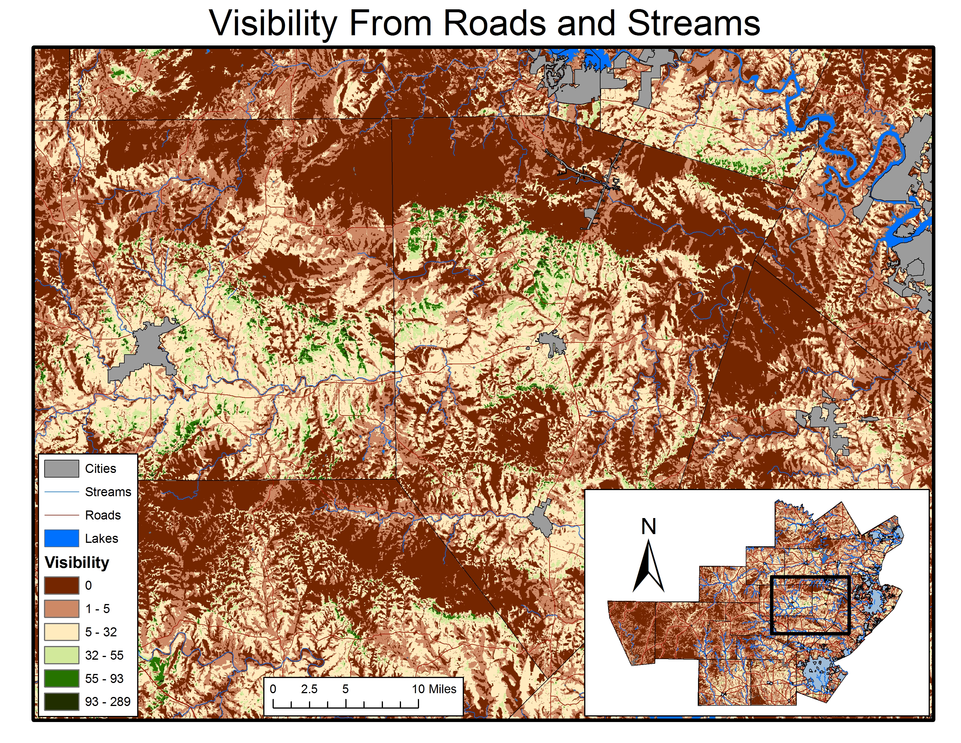
This is a map displaying an example of the roads & streams viewsheds. |
|
This is a Manifold map file using Real County as an example |
|
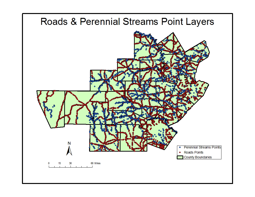
This is a map displaying the random point layers generated from the roads & perennial streams layers. |
|
This is a map of the study region with the scenic suitability model combined with the roads & streams viewsheds. |
|
Potentially Scenic Areas in the Texas Hill Country |
|
Roads & Perennial Streams Point Layers |
|
Manifold map file of Real County |
|
Visibility of Roads & Streams |
|
Potentially Scenic Areas visible from Streams & Roads |
|
Home | Project | Maps | Documents | Contact Us |
|
Site Design by N.E.R.D.S. 2010 | Contact Webmaster |